|
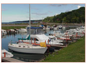
Ceylon Fisheries Harbor Corporation
The client is responsible for maintaining Fisheries Harbors around Sri Lanka, and they carry out Hydrographic Surveys of the water basins of the Harbors for the purpose of preparing the maps and the Land Survey of the harbors, including shoreline as well as the surrounding buildings, fixtures etc.,
In view of the above, required Differential Global Positioning System (DGPS) along with the software and hardware was been provided. The project, consist of single reference station (Trimble 4700 TRK/PP Base Station) that can be accessed by the Land (4700 Rover Receiver) and marine (Trimble DSM 212H Rover Receiver) rover receivers. The GPS receivers Base and the Rover are with Internal UHF rover radio with the antenna and the necessary field data processing software for mission planning, post processing and datum transformation.
|